Document set 'Land grant, 1789 June 6'
(A74__002__103)
Transcript style:other pages
 1 / 2
1 / 2 2 / 2
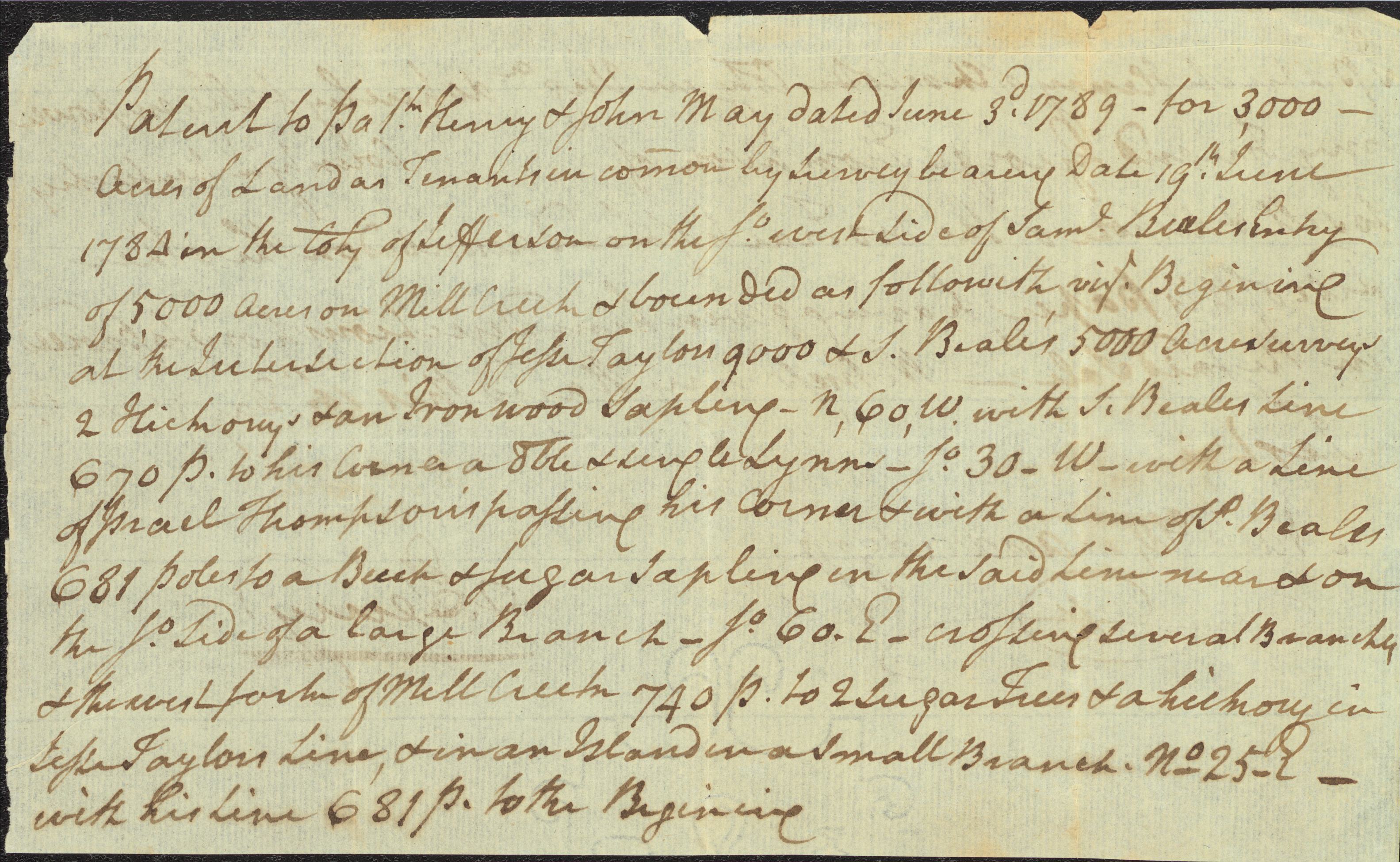
2 / 2 Patent to Patk Henry & John May dated June 3d. 1789 -- for 3,000 --
Acres of Land as Tenants in comon by Survey bearing Date 19th June
1784 in the City of Jefferson in the So. west Side of Saml. Beales Entry
of 5,000 Acres on Mill Creek & bounded as followith vizt. Begining
at the Intersection of Jesse Taylors 9000 & S. Beale's 5000 Acre surveys
2 Hickorys & an Ironwood Sapling _ N, 60, W. with S. Beales Line
670 P. to his Corner a dble & single Lynn _ So. 30_W_ with a Line
of Israel Thompson's passing his corner & with a Line of S. Beales
681 Poles to a Beech & Sugar sapling in the said Line near & on
the So. Side of a large Branch _ So. 60. E_ crossing several Branches
& the west fork of Mill Creek 740 P. to 2 Sugar Trees & a hickory in
Jesse Taylors Line, & in an Island in a small Branch. No. 25_E_
with his Line 681 P. to the Begining
<p-bgn>Patent to Pat<sup>k</sup> Henry & John May dated June 3<sup>d</sup>. 1789 -- for 3,000 --
Acres of Land as Tenants in comon <note>scribal abbreviation</note> by Survey bearing Date 19<sup>th</sup> June
1784 in the City of Jefferson in the S<sup>o</sup>. west Side of Sam<sup>l</sup>. Beales Entry
of 5,000 Acres on Mill Creek & bounded as followith viz<sup>t</sup>. Begining
at the Intersection of Jesse Taylors 9000 & S. Beale's 5000 Acre surveys
2 Hickorys & an Ironwood Sapling _ N, 60, W. with S. Beales Line
670 P. to his Corner a dble <note>scribal abbreviation</note> & single Lynn _ S<sup>o</sup>. 30_W_ with a Line
of Israel Thompson's passing his corner & with a Line of S. Beales
681 Poles to a Beech & Sugar sapling in the said Line near & on
the S<sup>o</sup>. Side of a large Branch _ S<sup>o</sup>. 60. E_ crossing several Branches
& the west fork of Mill Creek 740 P. to 2 Sugar Trees & a hickory in
Jesse Taylors Line, & in an Island in a small Branch. N<sup>o</sup>. 25_E_
with his Line 681 P. to the Begining

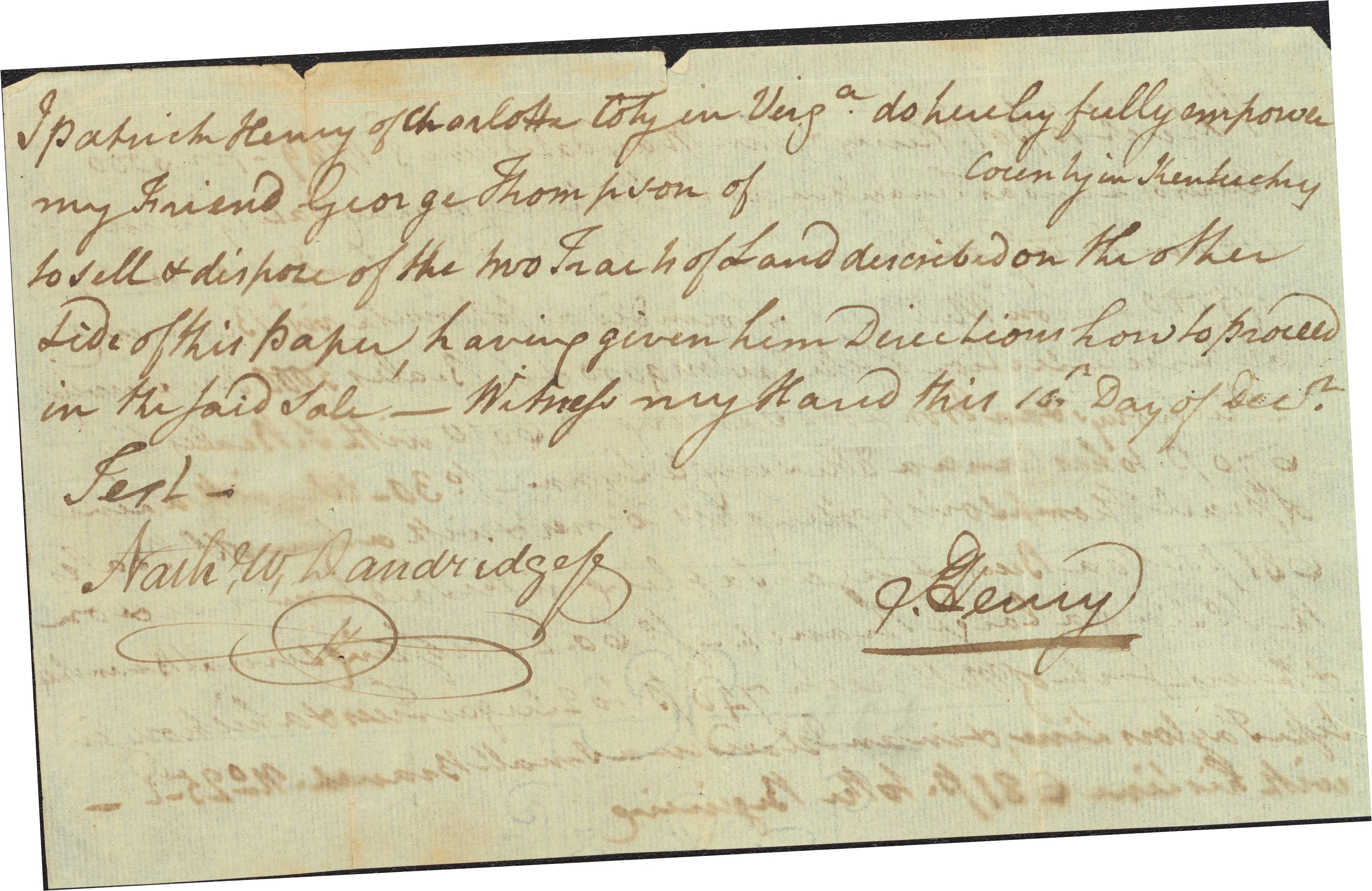
I Patrick Henry of Charlotte City in Virga. do hereby fully empower
my Friend George Thompson of county in Kentucky
to sell & dispose of the two Tracts of Land described on the other
Side of this Paper having given him Directions how to Proceed
in the said Sale -- Witness my Hand this 16th.[?] Day of Decr.
P. Henry
Test.
Nathl. W. Dandridge [?]
I Patrick Henry of Charlotte City in Virg<sup>a</sup>. do hereby fully empower
my Friend George Thompson of county in Kentucky
to sell & dispose of the two Tracts of Land described on the other
Side of this Paper having given him Directions how to Proceed
in the said Sale -- Witness my Hand this <unclear>16<sup>th</sup>.</unclear> Day of Dec<sup>r</sup>.
<und>P. Henry</und>
Test.
Nath<sup>l</sup>. W. <unclear>Dandridge </unclear>
